A medieval ditch and fence alignment encountered within the town of Ayr marks the boundary of the medieval burgh.
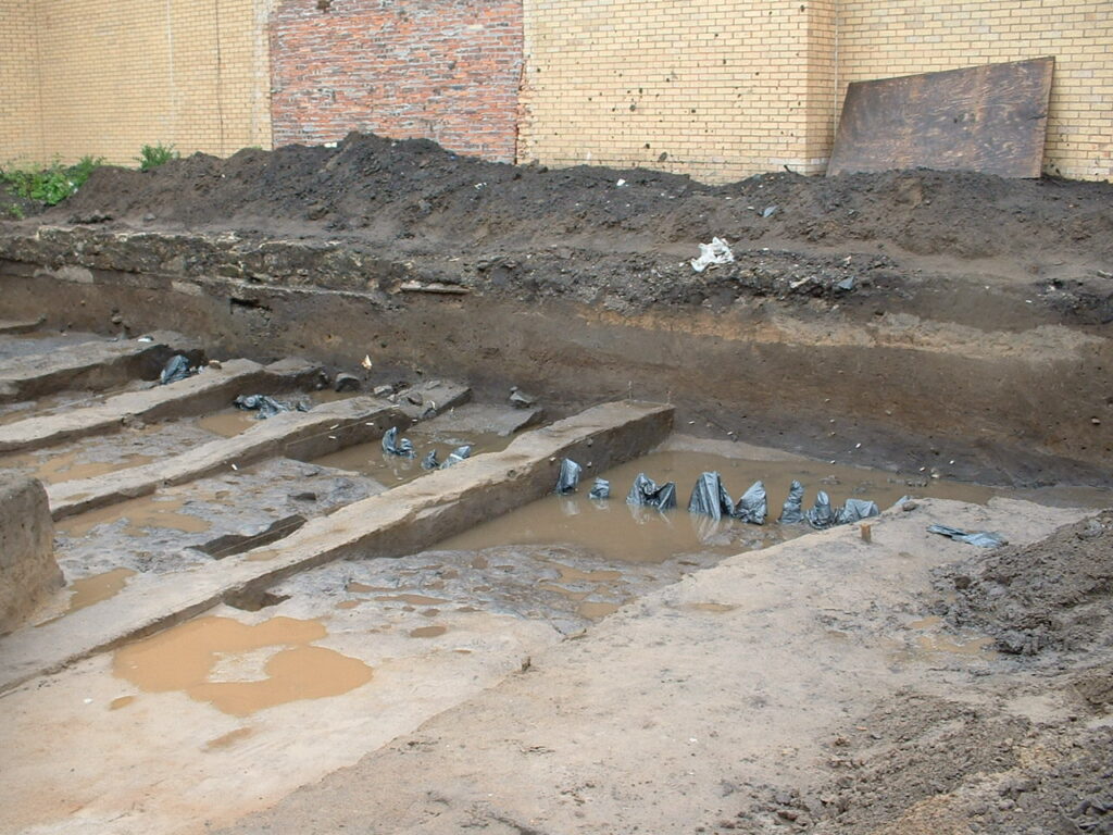
These archaeological remains were first encountered in 2002-2003 during excavations on the site of the now demolished Carrick Halls in the centre of the historic town of Ayr. A further intervention on the site in 2021 by GUARD Archaeology Ltd was made in advance of development, which allowed specialist analyses of the evidence from the earlier archaeological work to be undertaken.
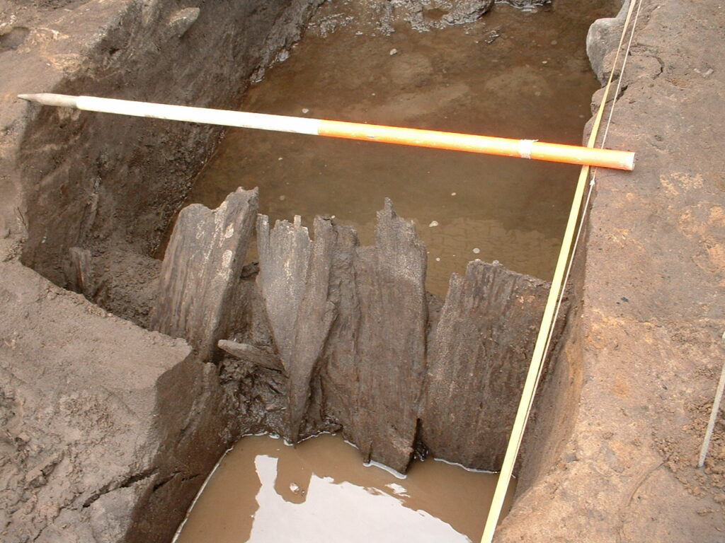
The earliest activity identified on the site was the creation of a ditch that formed a medieval burgage plot boundary between the mid-twelfth and early thirteenth century, in the period immediately preceding or during the initial town expansion. The boundary was reinforced in the middle to late thirteenth century by an oak planked fence with roundwood stakes erected in the middle of the ditch.
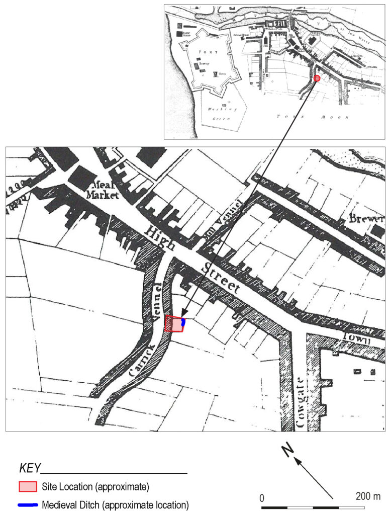
The location of the ditch is important in understanding the expansion of medieval Ayr to the south-east and it continued in use into the fourteenth century after which it was filled in. Evidence of iron smelting recovered from the ditch deposits indicated that metalworking took place nearby. The presence of Scottish medieval pottery and especially of imported French wares within the ditch deposits indicates that during the Middle Ages, Ayr, a royal burgh, was also an important international trading port.
The original excavations and subsequent analysis of artefacts found in the ditch revealed changes in land use and occupation of the burgage plot into the fourteenth and fifteenth centuries. The domestic uses of the land were brought to an end by the accumulation of windblown sand across the southern part of the town. A wide variety of plants were found growing on these deposits indicating that the plot may have remained as waste ground into the post-medieval and modern periods, prior to the construction and the eventual demolition of Carrick Halls in the twentieth century.
The full results of this research, which was funded by Ayrshire Housing Association, ARO57: Medieval Burgage Boundary at Carrick Street, Ayr by Tamsin Scott has recently been published and is now freely available to download from the ARO website –Archaeology Reports Online.